This is nothing like a complete collection. It's my personal collection -- maps that have caught my eye over the years.
This page originated as a blog post: "A treasury of Zork maps" (Feb 2023). I have archived the image files on this page, and added a few more, including some from Colossal Cave (Adventure).
As you can see, I am most interested in historic and artistic maps. I've also developed a yen for maps of the real Colossal Cave -- more properly known as Mammoth Cave, now that all the caves around Flint Ridge and Mammoth Cave National Park are known to connect.
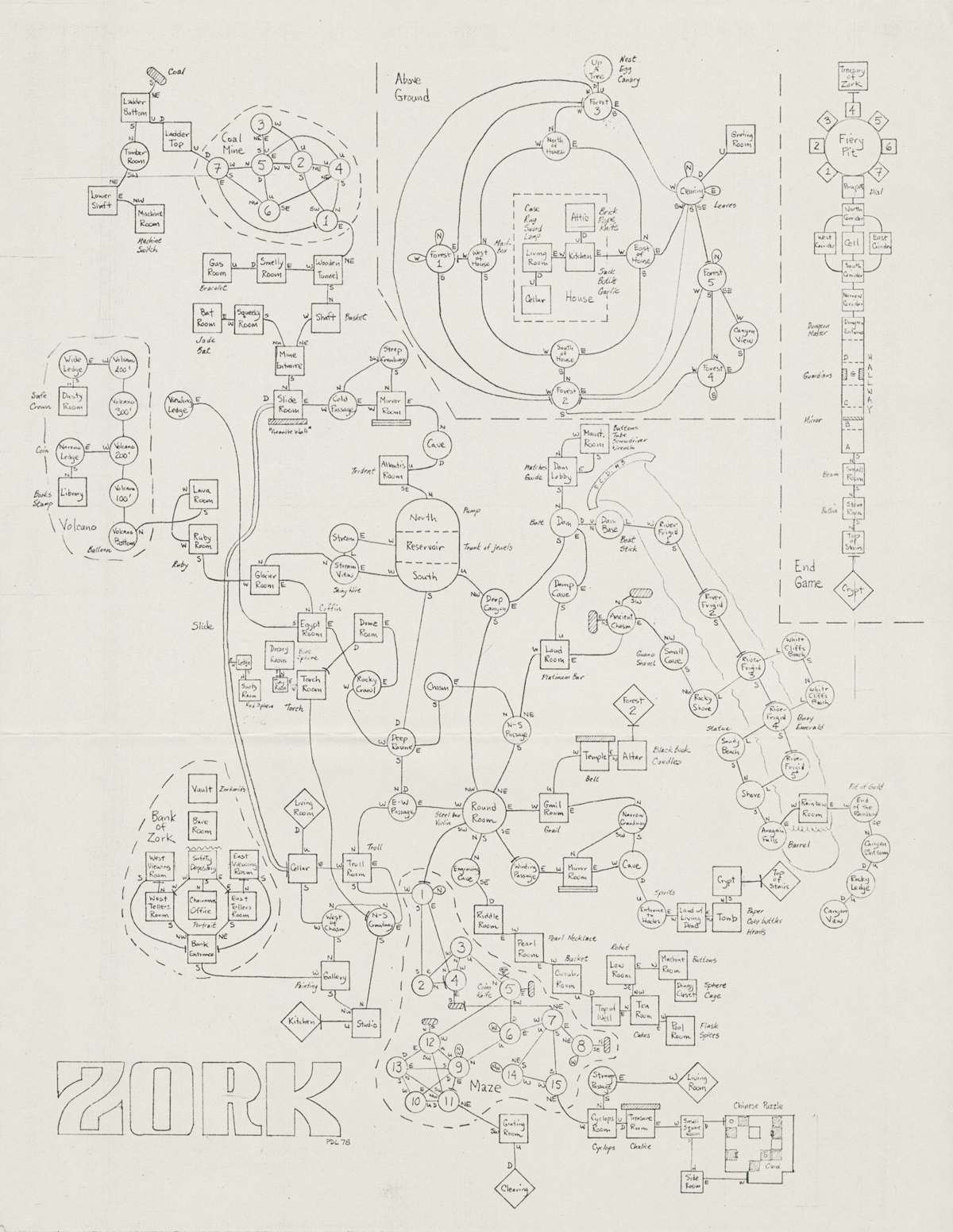
Map of Zork (MIT version), drawn during development by Dave Lebling.
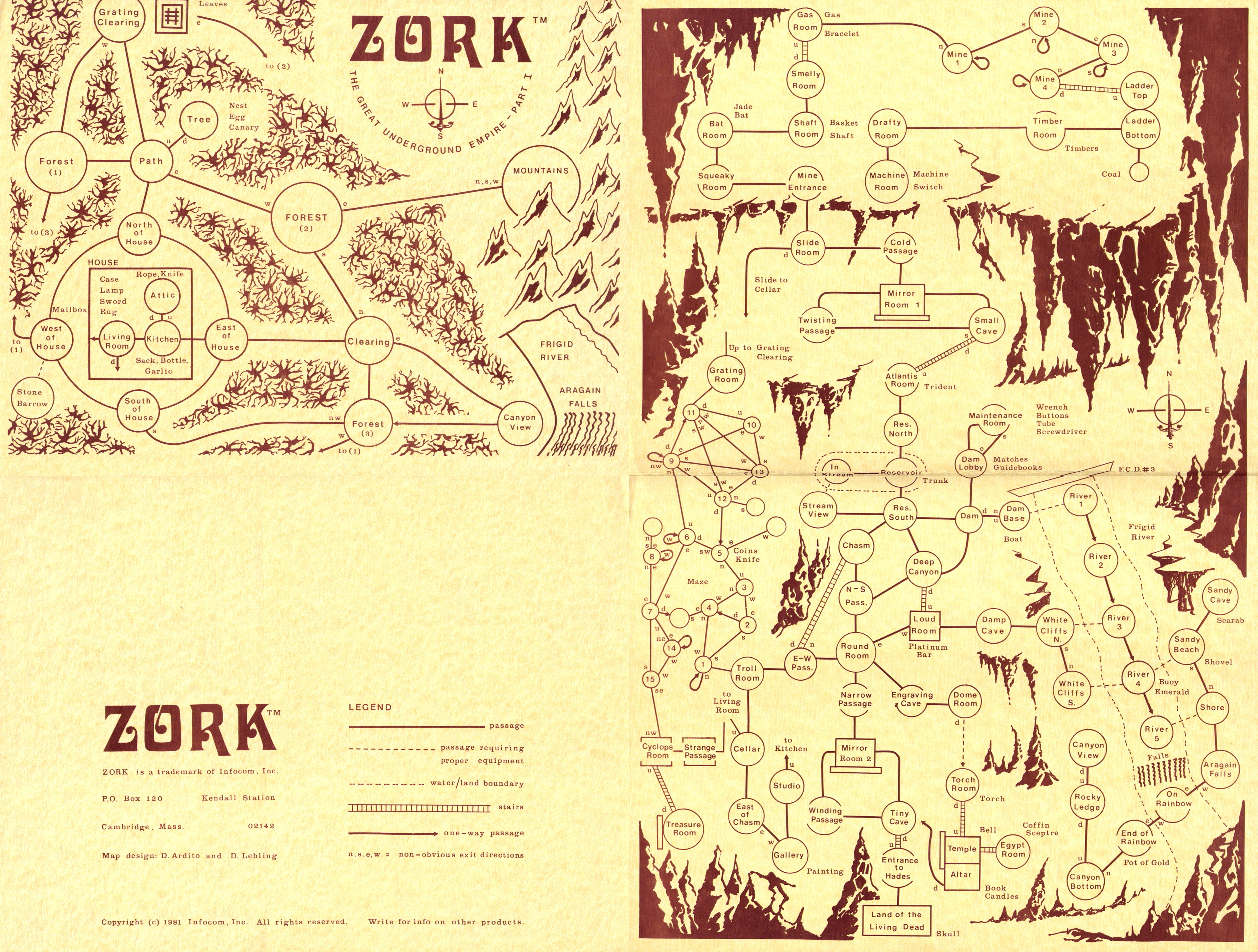
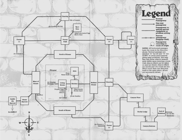
Map of Zork (1), drawn by David Ardito after Lebling's 1978 map. Published by Infocom as hint material. The "Movement Assistance Planner" was advertised in the Personal Software releases of Zork (the .z1 versions).

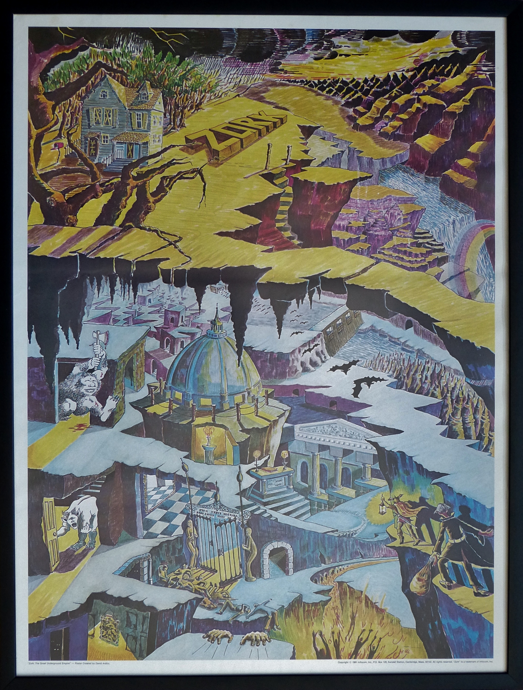
Poster of Zork (1) by David Ardito, published by Infocom.
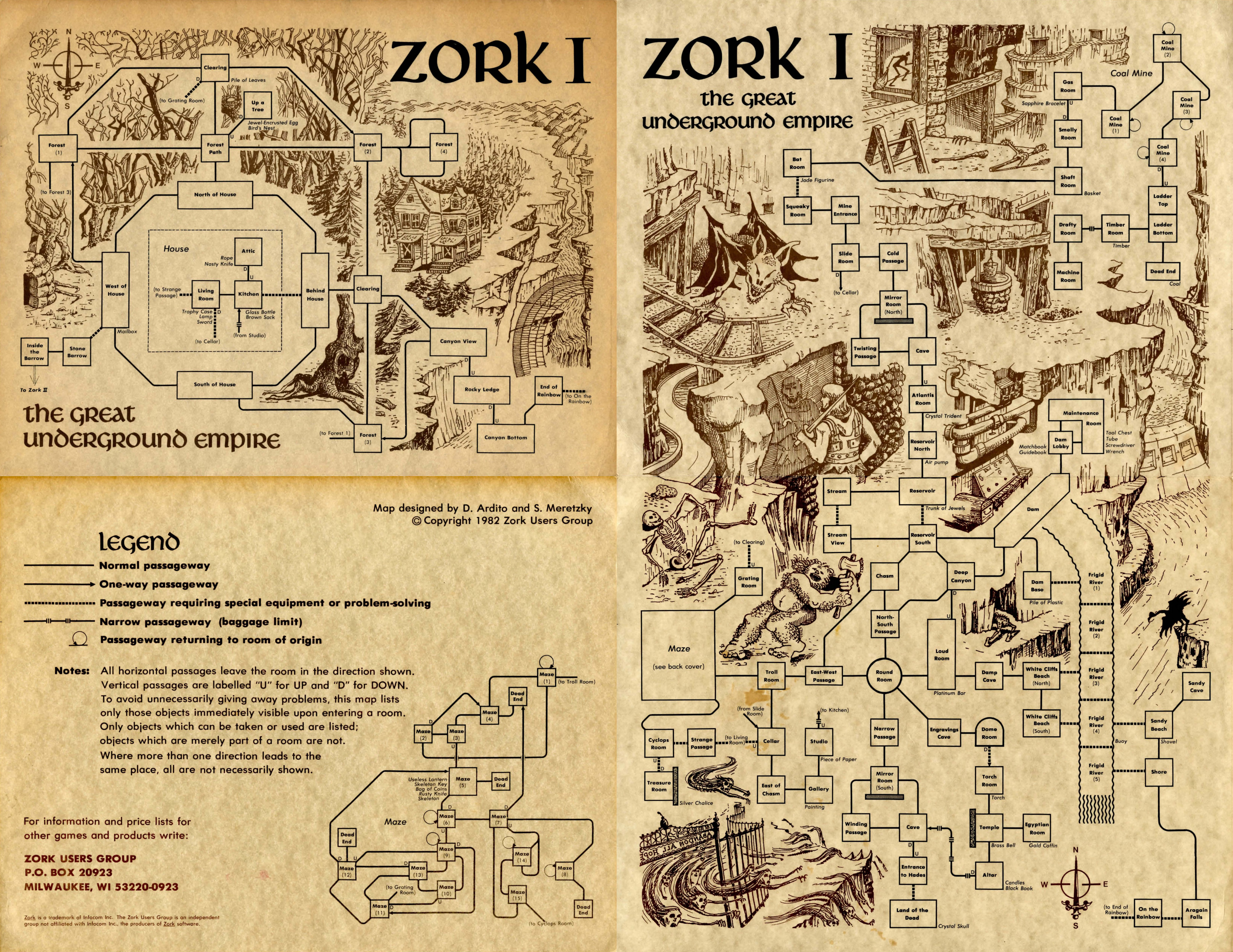
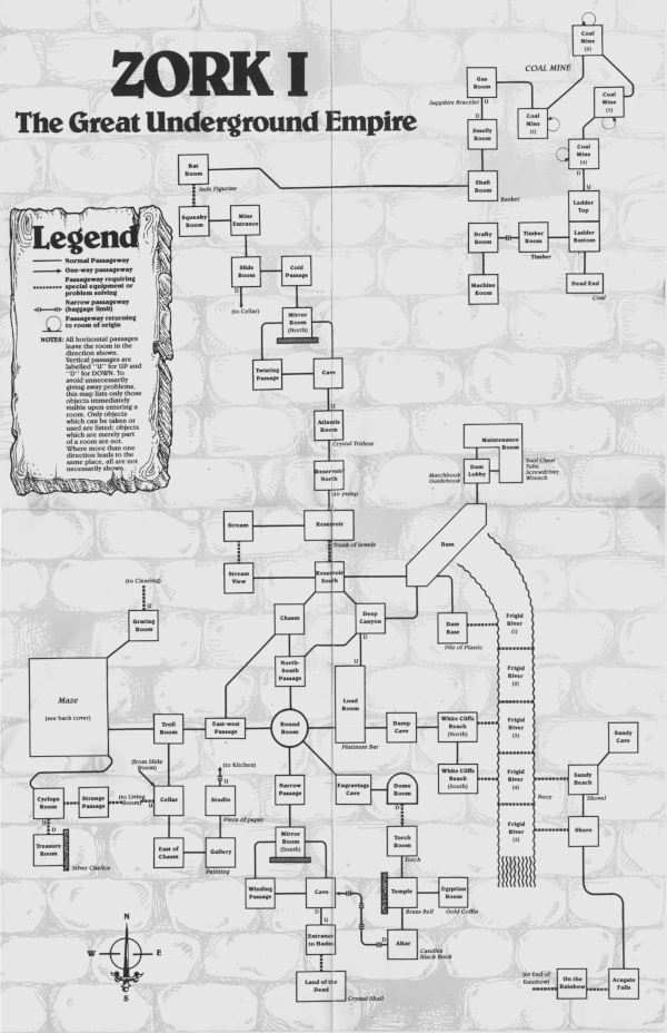
Map of Zork 1, designed by Steve Meretzky with art by David Ardito. Published by the Zork Users Group as hint material. This is a redrawn version of the 1981 map, released during the period when ZUG was a separate company handling Infocom's marketing.

Poster of Zork 2 by Pier Giovanni Binotti. Published by the Zork Users Group.
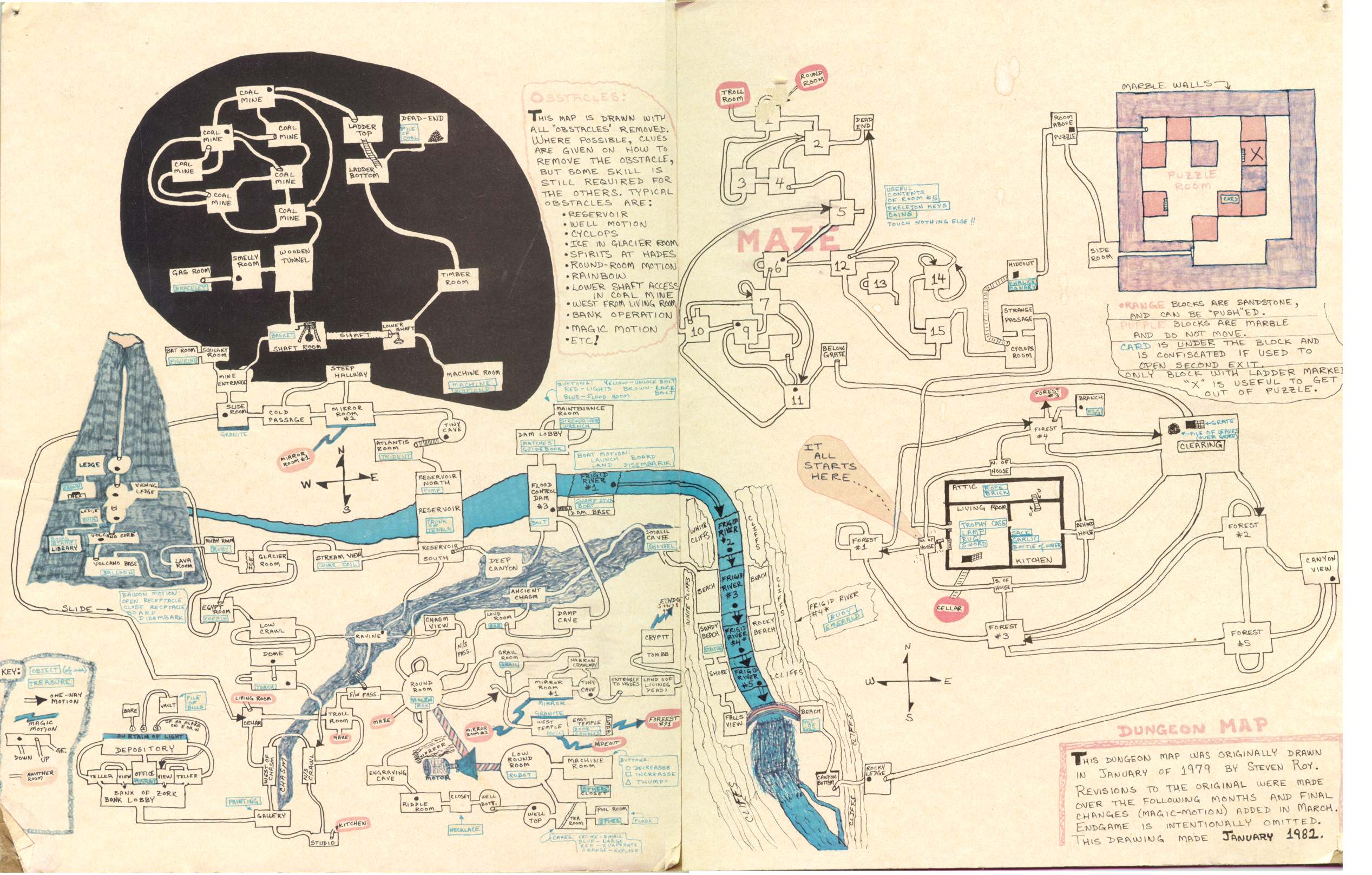
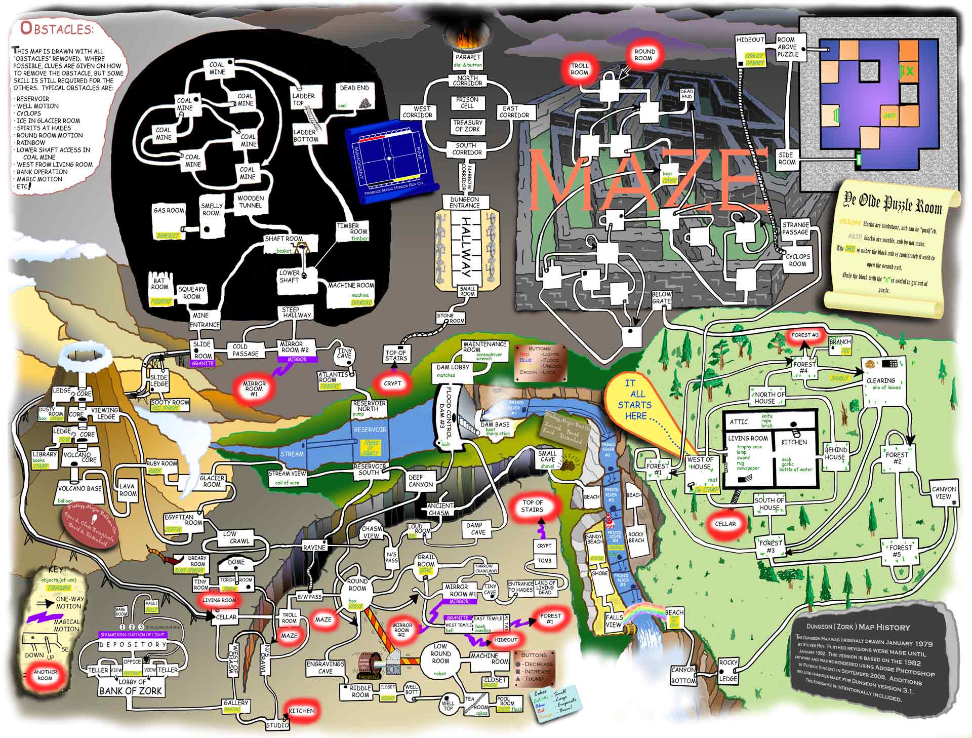
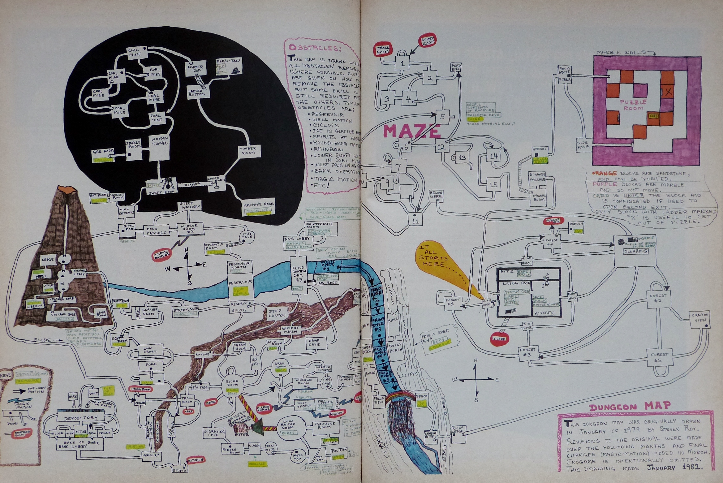
Map of Dungeon (MIT Zork) by Steven Roy. Originally published in DEC Professional magazine, 1982.

Enhanced version of the Steven Roy map, recolored and with the endgame area added in. Created by Jeremy Kapp.
Redrawn version of the Steven Roy map, with the endgame area added in. Drawn by Patrick Vincent in Photoshop.

Map of Zork 1, published by Infocom as hint material. This is the same as the 1982 ZUG map, except for the font and the background detail.
Rendering of the Zork (1) map in the shape of the word "ZORK". Drawn by user cart00nlion.
Map of Dungeon (MIT Zork), drawn by user ion_bond. Inspired by the Steven Roy map.

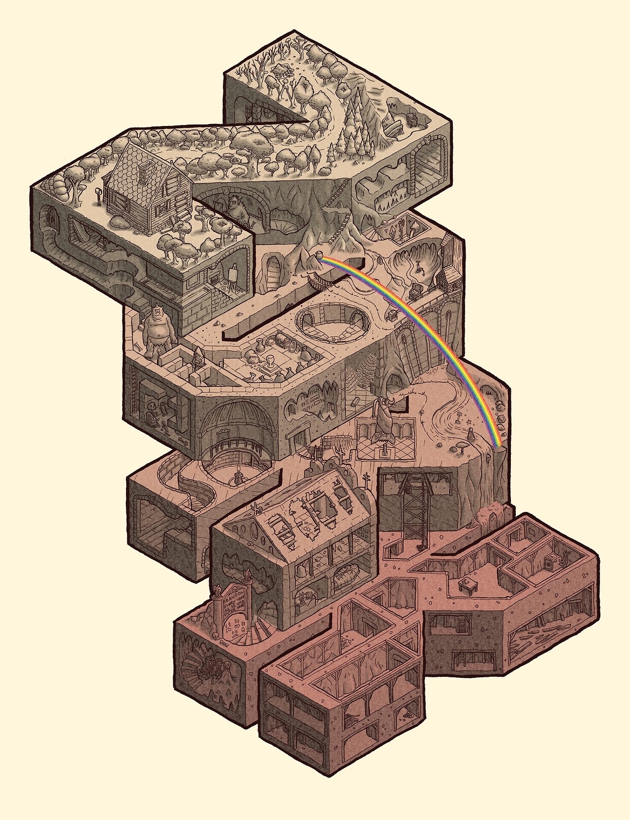
Map of Dungeon (MIT Zork) by user ion_bond. Redrawn from the 2017 map with an isometric layout.

Map of Dungeon (MIT Zork) by Aaron A. Reed. Created for the 50 Years of Text Games project. (CC-BY-4)
For a history of the mapping of Mammoth Cave, see Mapping of Mammoth Cave: How Cartography Fueled Discoveries (Roger Brucker, 2008). This paper mentions all the real-cave maps below, and a whole lot more.
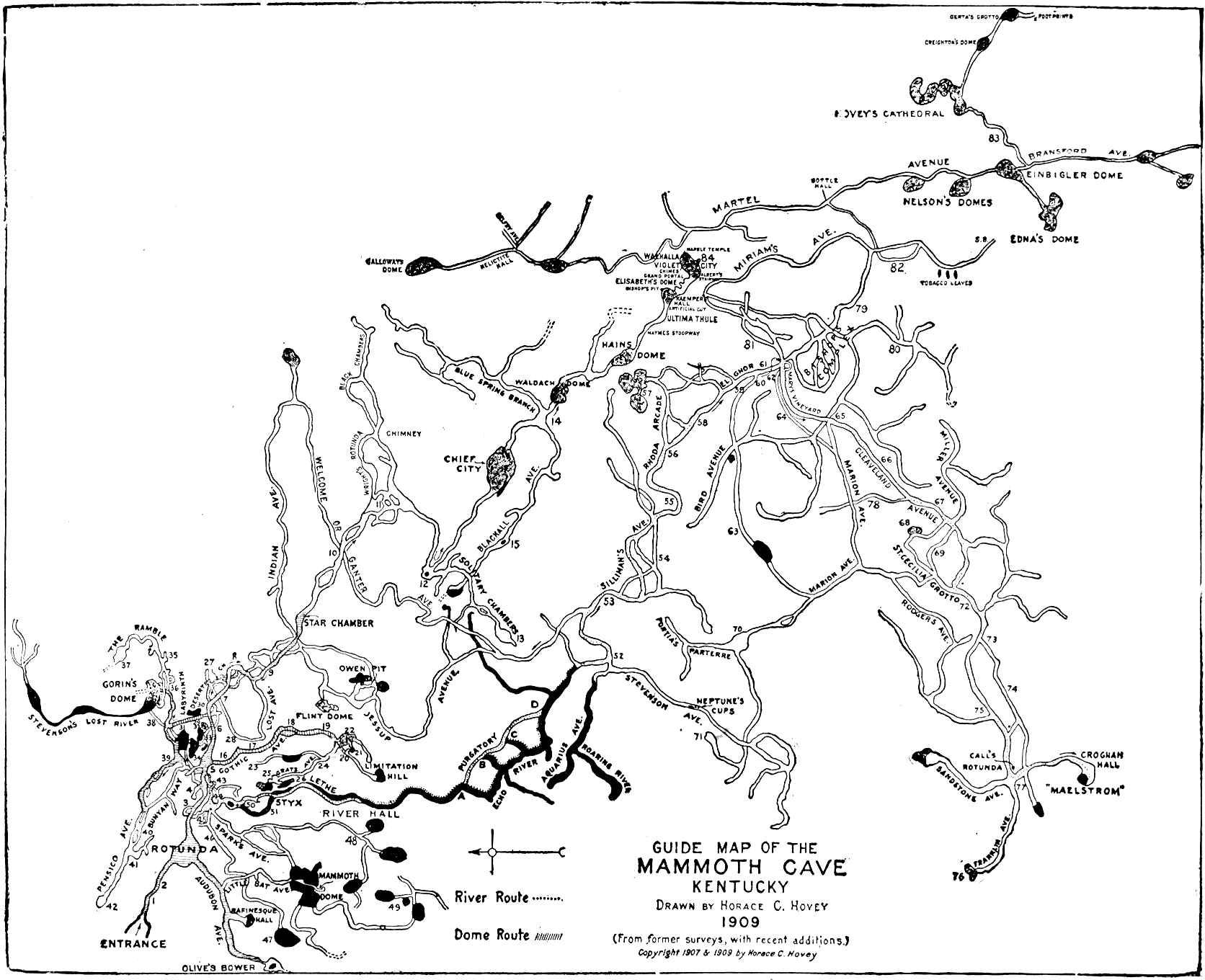
Map of the real Mammoth Cave, as surveyed by a professional surveyor in 1834-5. This shows a top-down view of the cave as it was known at the time, and horizontal sections of many of the passages.
This map does not cover the area described by the Colossal Cave game; that region is more properly called Bedquilt Cave. Bedquilt and the other Flint Ridge caves were not proved to connect to Mammoth Cave until 1972.

Map of the real Mammoth Cave, drawn from memory by Stephen Bishop, one of the first experts on the cave system. Published in Rambles in the Mammoth Cave During the Year 1844 by a Visitor, Alexander Clark Bullitt, 1845.
Again, this is Mammoth Cave, not Bedquilt Cave. However, according to Graham Nelson, it does include the "muddy passage" discovered by Patricia Crowther in 1972. Roger Brucker notes: "As an interesting sidelight, Bishop’s map shows the passage off Echo River through which the 1972 connection with Flint Ridge was made."
This map was drawn in 1871. However, it was not published until 1899, because it showed passages running outside the boundaries of Mammoth Cave Estate (not yet a national park). The "Kentucky Cave Wars" over tourist traffic were fierce; the owners of the estate had no intention of letting anybody else get a whiff of an alternate entrance.
Kaemper (or Kämper) was guided by Ed Bishop in doing this survey. But again, the map showed that Mammoth Cave extended outside the then-current owner's property, so it was stashed away. Mammoth Cave was made a national park in 1941, and the map was rediscovered by the National Park Service in 1963.

Published in The Mammoth Cave of Kentucky, Horace Carver Hovey, 1909.
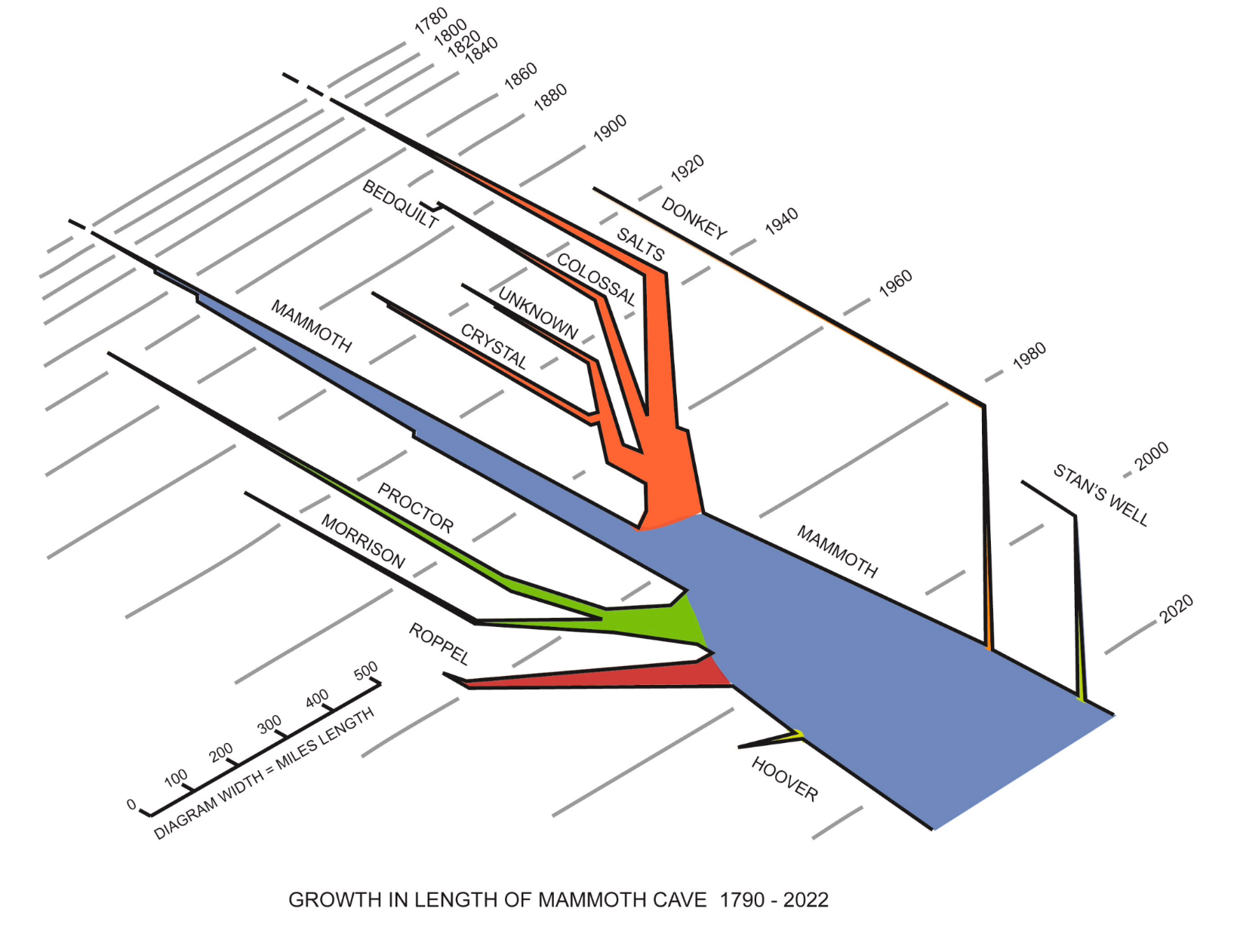
This of course refers to the growth of the total surveyed length of Mammoth Cave. As surveys (chains of markings like "Y2"!) put more of a cave on the charts, the indicated branch of this diagram grows wider. When a survey connects two previously separate cave systems, the branches merge.
Note the explorations around 1960 which joined Colossal Cave proper to other caves, forming the Flint Ridge cave system. The orange-blue junction is the 1972 expedition that connected that system to Mammoth Cave. (See The Longest Cave, Brucker/Watson.)
Published in the Cave Research Foundation newsletter, Feb 2023. (There does not seem to be an online archive of this newsletter.)
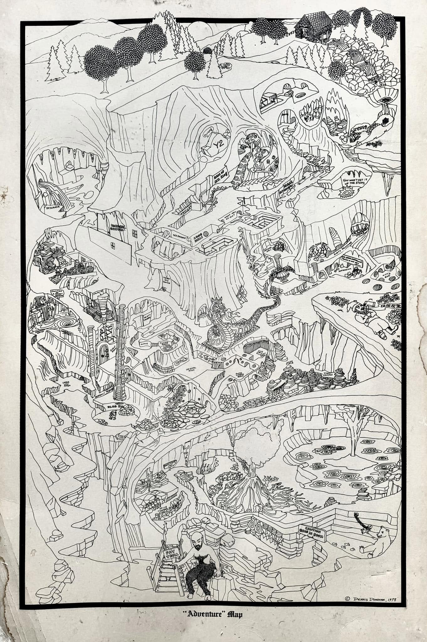
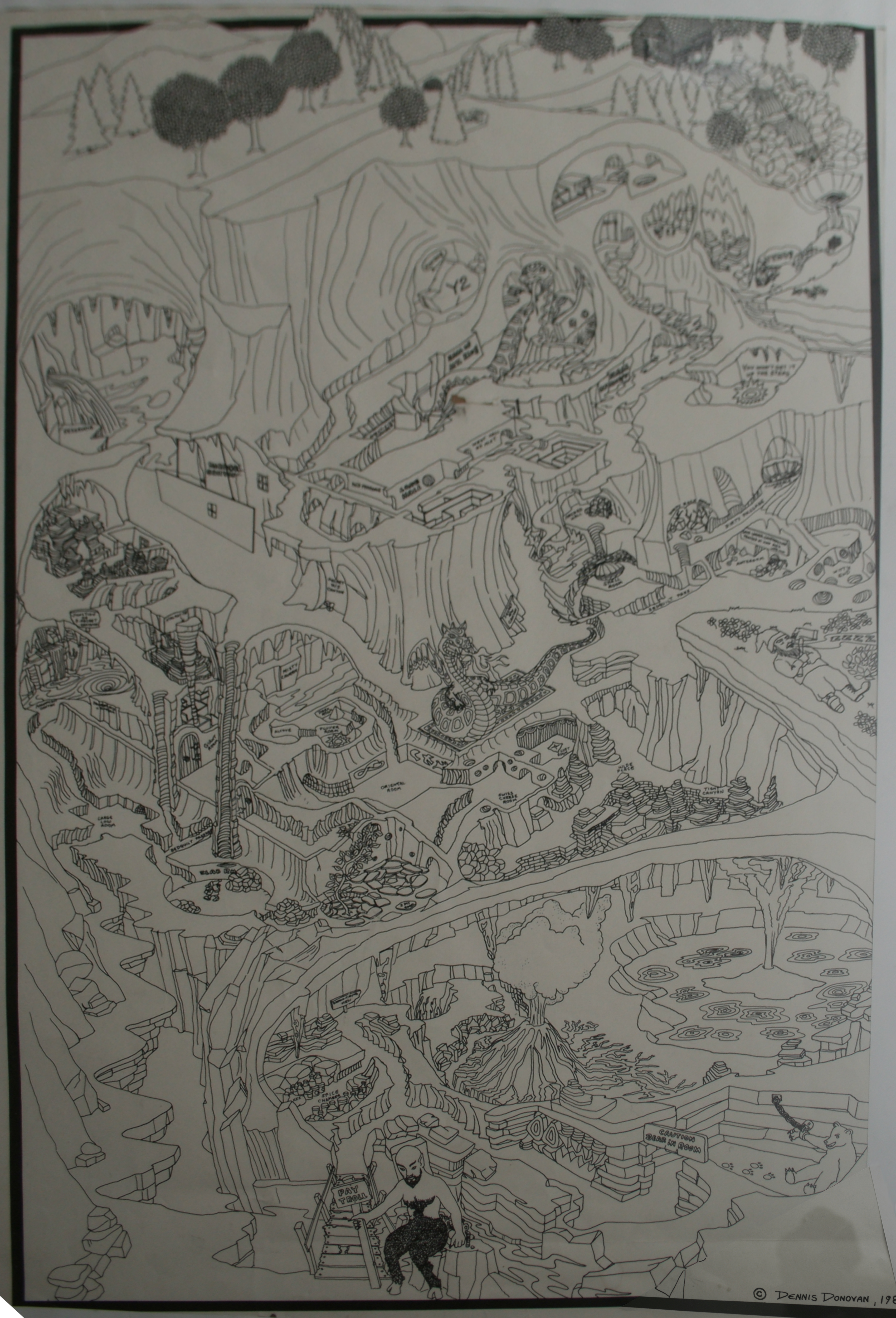
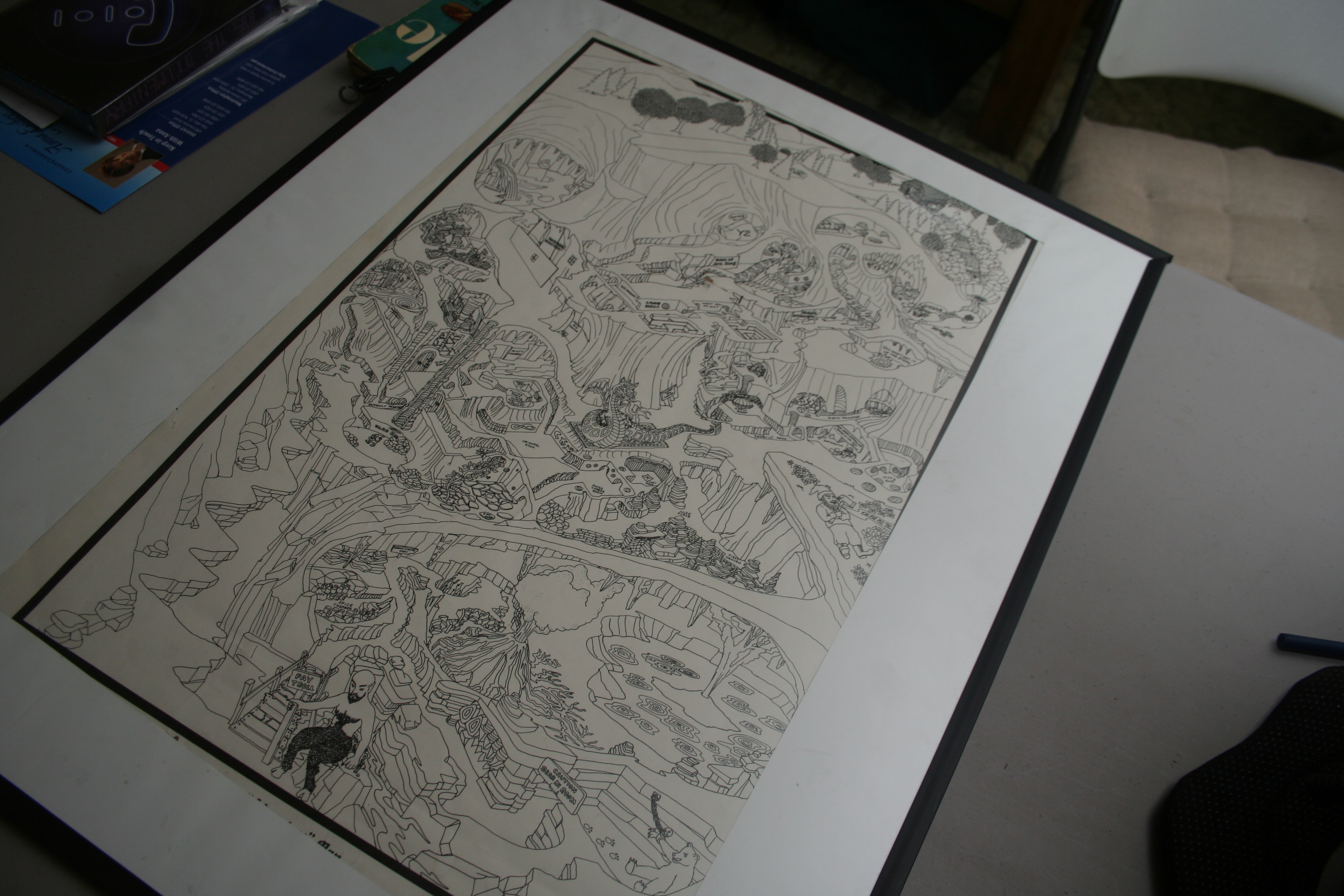
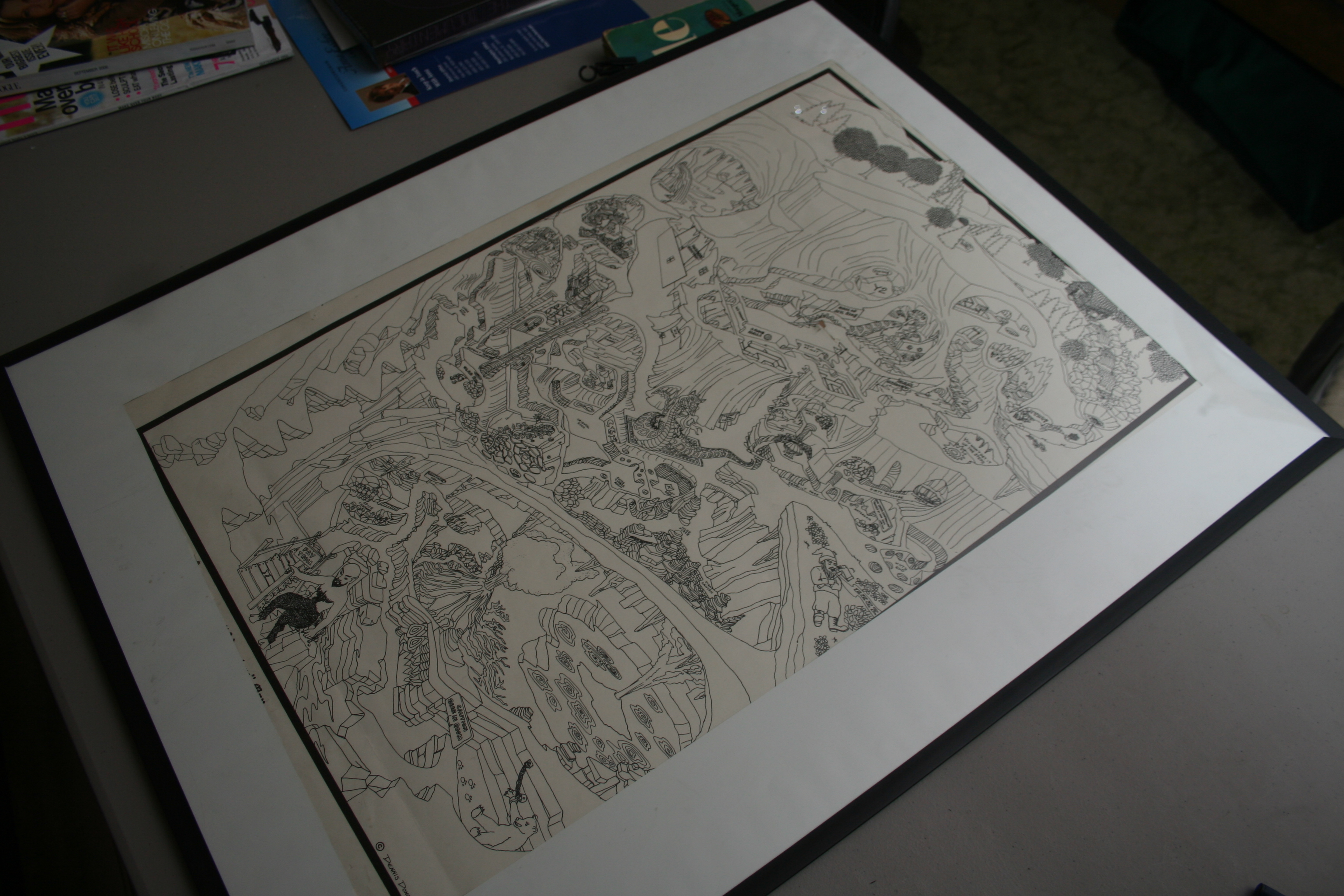
Map of Adventure, drawn by Dennis Donovan. Reproductions sold by CompuServe.
The only difference I see between the versions, aside from the copyright date, is that in 1981 the dragon has acquired a pair of arms. (Can't call them legs, really.)
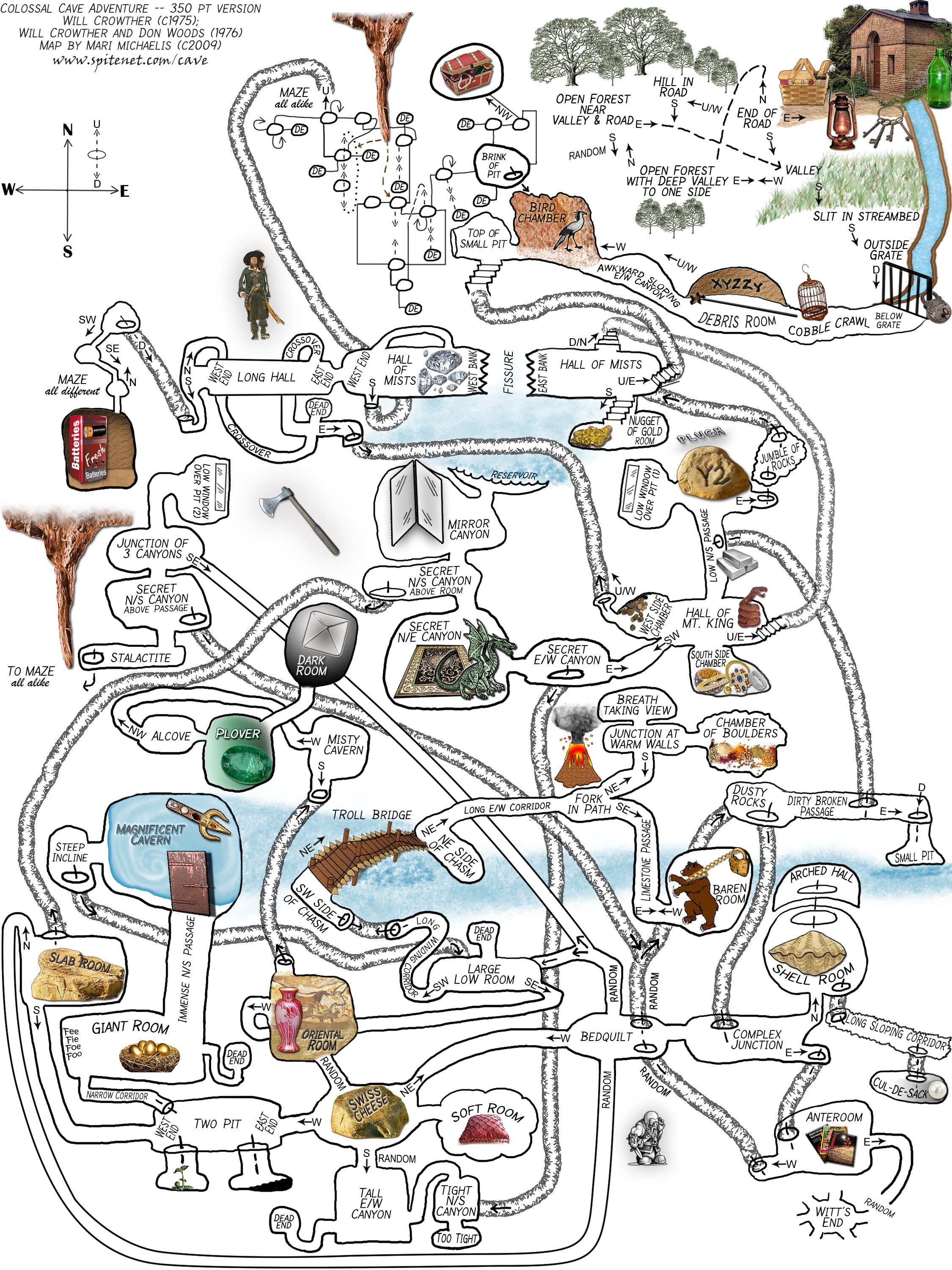
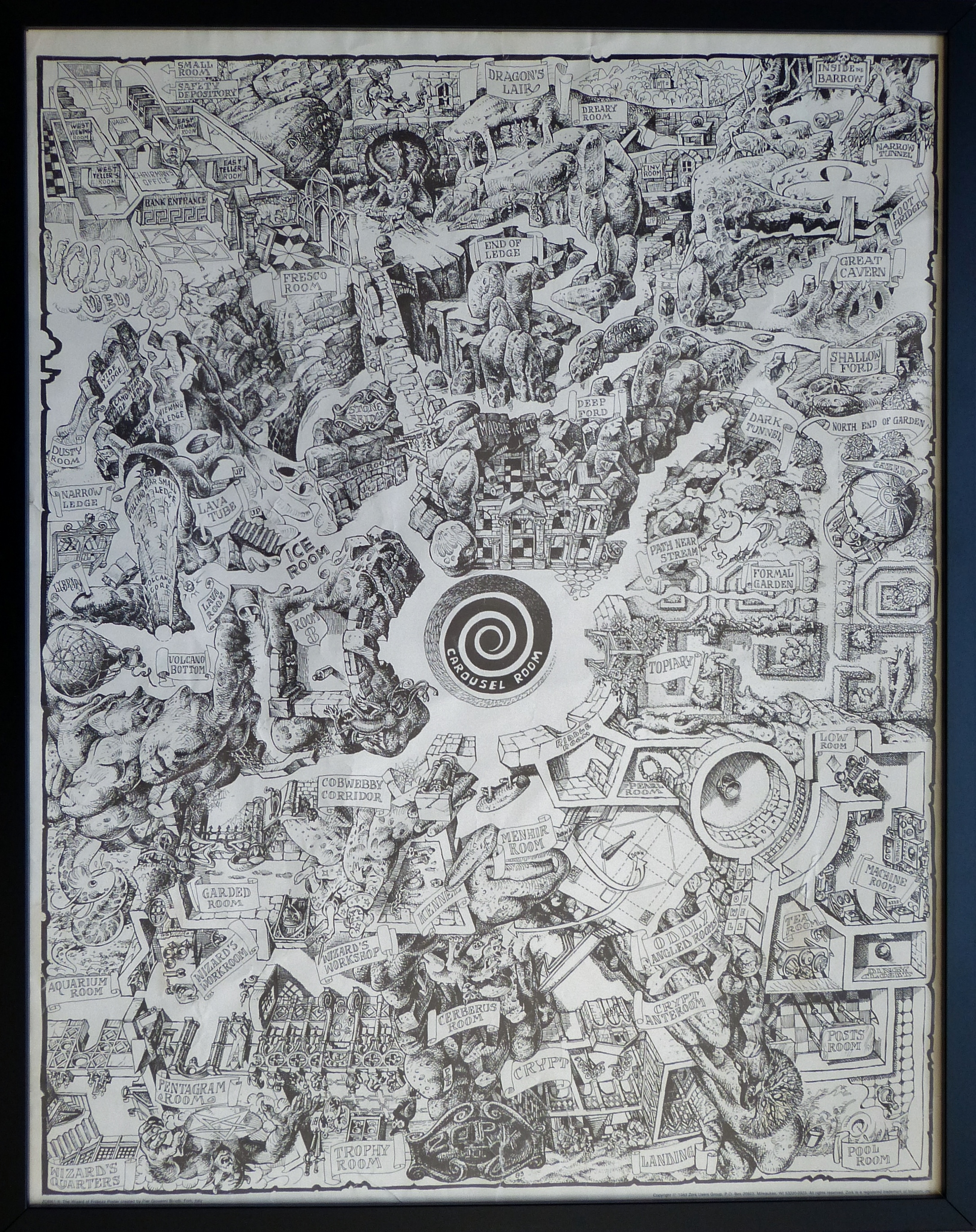
Map of Adventure, drawn by Mari Michaelis with image clips illustrating the treasures and hazards.
Last updated July 7, 2026.